I was surprised to hear from a friend in Victoria that one of my favourite Recreation sites is closed to overnight camping, and it is closed for the foreseeable future according to Robert van der Zalm, the BC Coast Regional Manager for Recreation Sites & Trails. The site is closed for all of this year. He said a review of service levels will be conducted in the fall. I guess that means looking at the budget. So there is no guarantee it will ever be open for camping again.
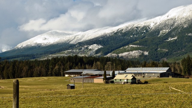
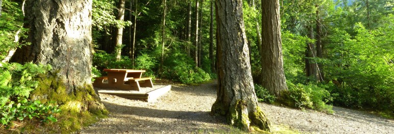
But it is a beautiful campsite, the most beautiful in the Alberni area. You camp in a large stand of very tall old Douglas Fir and Hemlock. There are 12 sites, some of which are a short walk in. A wild creek thunders down the mountainside past the campsite. A little path allows you to get great views of it. A long rocky beach with willows and logs piled around allows visitors to have a swim and some privacy as well if you want. When we last visited, we saw someone on a paddleboard across the lake at the other recreation site, Blackie’s Beach. The access is remote, but it is a bumpy two-wheel-drive all the way. That site is not closed, but has only 6 sites.
This campsite is mentioned several times on the web. And there are more websites about the circle route, the drive from Port Alberni south along the western shore of the Alberni Inlet before turning inland and up along the north side of Nahmint Lake to the campsite at the north end. From there the road continues to a junction. The right fork takes you up and over a pass with Gracie Lake in it, before descending to Sproat Lake. When you get close to the lake a fork takes you eastward, back to Port Alberni.
The Nahmint Lake area is popular. Patti and I did the driving tour last weekend. We encountered people all along the route, and even on a side tour upriver from the lake. Where we crossed a big bridge over the river at the north end of the lake, a fellow on a bicycle showed up. He had started in Port Alberni, 56 km back. And he had another 27 km to go back to town. Some of them were fishermen. Others were touring on motorcycles. And some were just out for a picnic by the lake, like us.
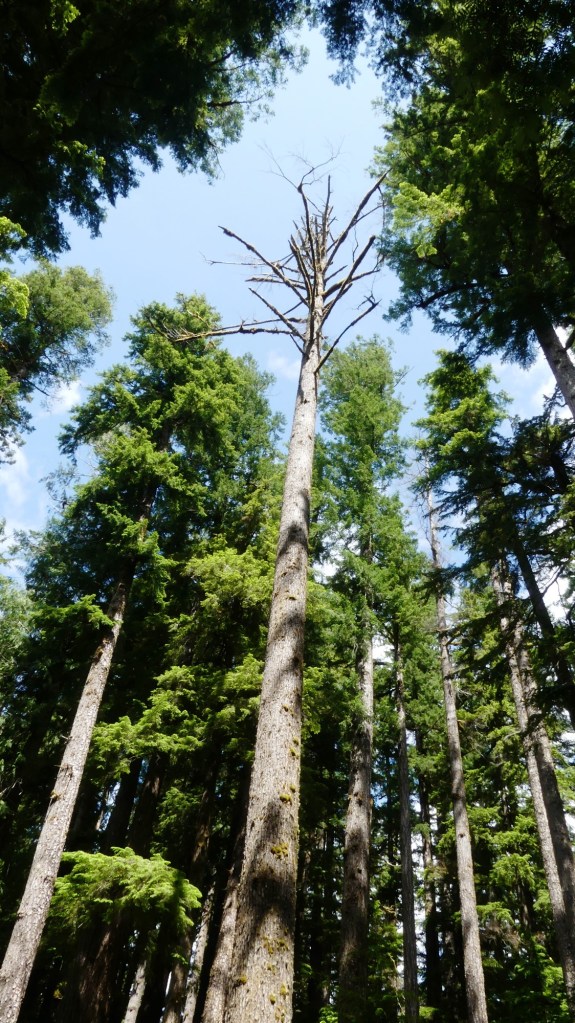
The gate to the Nahmint site is closed and a sign is posted announcing the closure of the site due to “overhead hazards caused by dangerous trees.” But there is a small turnout by the gate where there is room to park and walk down to the site. I didn’t see any wind-thrown trees hung up in other trees or anything. I did observe a few dead trees with limbs that could break off. Each has a number spray-painted on the trunk. One of them had the top broken off, and the top had driven itself into the soil a good two feet in its fall. It is truly alarming to think what that could have done to someone.
However, it does seem a shame to think that government isn’t providing enough money to keep a popular Recreation site open.
Humph.