A couple of weeks ago, several staff from the City met with Lyman Jardin and me at the footbridge over Roger Creek to discuss possible routes to create a path from the “bridge to nowhere” off the end of the Scott Kenny Trail, to Roger Creek Park. This route has been promoted as part of a pedestrian system through the city.
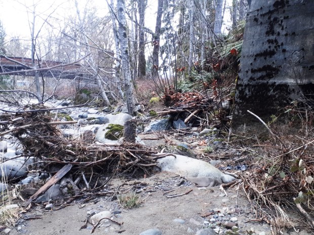
City CAO, Tim Pley introduced the new City Engineer, Rob Dickinson, and Rob Gaudreault before heading off. We climbed down from the railway tracks to Roger Creek observing the obvious signs of potential slides and slope failure, and then hiked through the brush along the south side of the creek. We got as far as the proposed bridge crossing that would bring the trail to the south side. It has to cross the creek, as there are big gravel cliffs and old slides along the north side just downstream. There is no possibility through the upper part of the north side.
Of course we talked the entire time. Eventually it was determined that there are three possible routes:
- The South Side Riparian Route,
- The Lower North Side Route, and
- The Upper South Side Route.
Each has their plusses and minuses. Here is a link to a map of the choices: https://www.google.com/maps/d/edit?mid=1GaAUUijvTnZKdHRc_xeBbeAmyVnTFRFh&usp=sharing
The South Side Riparian choice seems to be the one preferred by the city staff. They were pushing it during the conversation. Dickinson remarked that you can build anything if you have enough money. You can’t argue with that. But there are some issues with this choice. It is the one that will have the biggest impact on the Salmon left in Roger Creek.
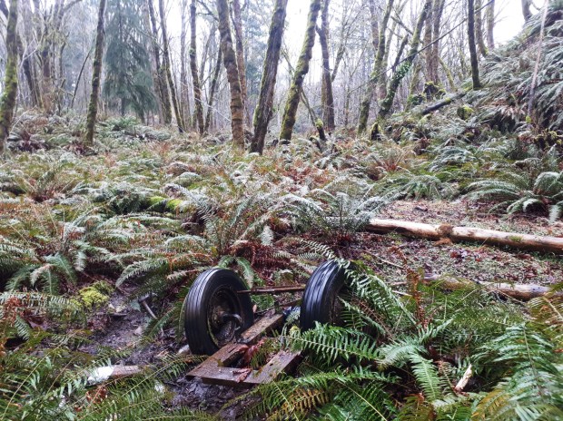
It still is a fish creek, despite many habitat damages along it besides logging. But it is a shadow of what it once was in former times. A land fill was located on its bank. A storm water drainage pipe empties into a settling pond behind the fair grounds. There are now 5 bridges across its lower reaches. The Scott Kenny Trail has opened up the forest along its banks exposing the creek to dangerously elevated temperatures in the summer. Side channels for rearing and overwintering salmon, and settling pond for the storm water runoff were constructed at the same time as the trail. This opened up a large area to the heat of the sun. But all of them are stagnant, unsuitable habitat for salmon. A reforestation reforestation attempt was done clumsily, and a crucial part of it around the rearing channel failed. A number of vehicles were pushed over the rime and are there still. And over the last few years someone has been dumping fill into the creek near the mouth of the creek.
Yet still, it is considered a fish creek. There are 9 kms of suitable habitat before a waterfall barrier prevents further habitat use upstream. Signs are up in Roger Creek Park telling them about salmon and the salmonid habitats of the creek. In 2017 during construction of the Scott Kenny Trail, a settling pond and rearing channels was built, as well as 2 other side channels further down. And I have photos of Coho parr from 2014. And there have been other efforts as well to enhance habitat and restore fish to it.
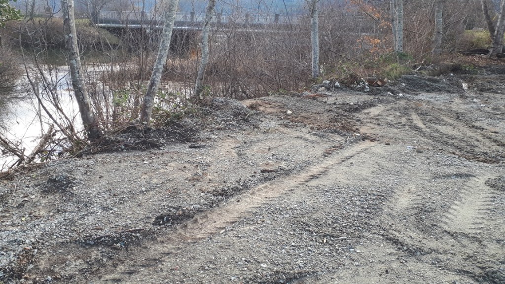
Fill dumped into the mouth of Roger Creek
All that aside, the most contentious part of the proposed path is the 100 meters just upstream from the Roger Creek pedestrian bridge. Here the rail trestle crosses the creek. And the cement support columns stand at the very edge of the creek. Every fall and winter the base these columns are washed by the flooding creek. There is no place to put a path under the bridge unless it is elevated above the highest water mark and supported by one of these columns; or unless the city gets special dispensation from Fisheries and Oceans.
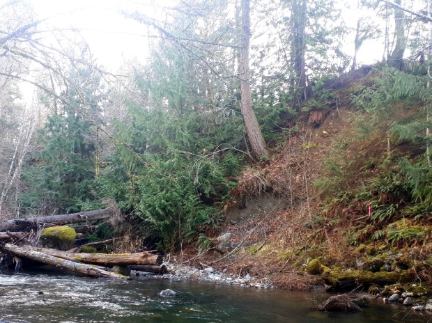
The South Side Riparian route also follows the base of a very steep muddy bank with a recent slide scar on it and plenty of other signs of slope instability. At the bottom of the bank is Roger Creek. There is a very high probability that any construction at the base or along the bank (such as cutting trees and brush), would cause a slide. And again any path constructed would infringe on the creek itself because there is so little room below the bank. Can we take that chance on a salmon run that is in such a precarious state?
The Lower North Side, follows a route similar to the South Side Riparian Route, but after half way the path would cross the creek and go under the column on the north side of the creek. Again it would infringe on the creek as it is as wide as the columns. However the slope stability issues are not present. In their place though is the fact that the path would impinge on the private party of an influential citizen who has made it clearly known that he would not permit this to happen in his own back yard.
The third possibility that I like is to climb the ravine from further upstream and connect either to the north end of Glenwood Drive, or follow the edge of two properties where there is an existing rough and sketchy trail to the railway tracks. This route eliminates slope stability issues. But near the top it is steeper and may require steps near the top.
It also means dealing with two private property owners. However, these owners may be more sympathetic to the cause. One of them is JW Berry Trucking who has already acknowledged that there is a lot of foot traffic along the back of his property by building a path of his own. The other property is owned by Heatherington Battery. And they keep porta-potties inside a tall chain-link fence. The existing “trail” is at the very top of the ravine, at the top of the very unstable slope. Tim Pley made a remark that gave me the impression that Hetherington might be amenable to selling a ten-foot strip along the north end of his property, enabling a safer path to be built away from the top of the ravine. That would get the route to the right-of-way of the railway tracks.
The right-of-way is owned by the Island Corridor Foundation. Pley was doubtful whether the Island Corridor Foundation would be amenable to permitting pedestrian traffic to cross the railway lines. After all their purpose is to restore the rail line. There may be a possibility of constructing steps down from the Hetherington property and under the tracks between the south column and the approach embankment. There is a fairly level spot there and then more steps will easily take you down to the approach to the south end of the footbridge. All of the proposed routes will cross the right-of way of the Island Corridor Foundation whether over the tracks or under them.
Of course it all comes down to money. Pley says that the City is able to write a proposal for a million dollars that will enable them to get the money. However, they still haven’t consulted fisheries for their opinion/conditions, or a geotech about slope stability. Nor has any engineering been done. I understand that some of the grant money will go towards that. And what’s designed will be contingent on what fisheries and the geotech has to say, as well as the Island Corridor Foundation’s permission.
It should also be contingent on a decision that the city must make about the level of access that is desired. Is the path going to be wheel-chair-accessible, or accessible for cyclists? Or will it be accessible to pedestrians able to climb steps. From there plans can be made and estimates of cost after that. I hope that this third alternative, the one along the top of the ravine, is not dismissed and left un-costed. Then we will see whether the costs of each alternative are reasonable or whether this trail will even be built, period. Personally, I think this is ambition to have a trail continue down Roger Creek to the park is a tough nut to crack if the City Council demands gentle grades for this trail.