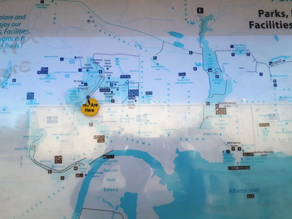
I’m actually going to make an election promise! I promise that if I am elected to city council, I will fight tooth and nail, scratching and clawing to get better signs at the trailheads around town by the end of my term. I want the trail maps to have North at the top, to have the roads visible and not just the road names, maps that aren’t so faded you can’t read them anyway. They’ve been like that for at least 4 years. It’s just embarrassing.
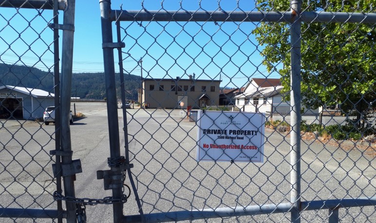
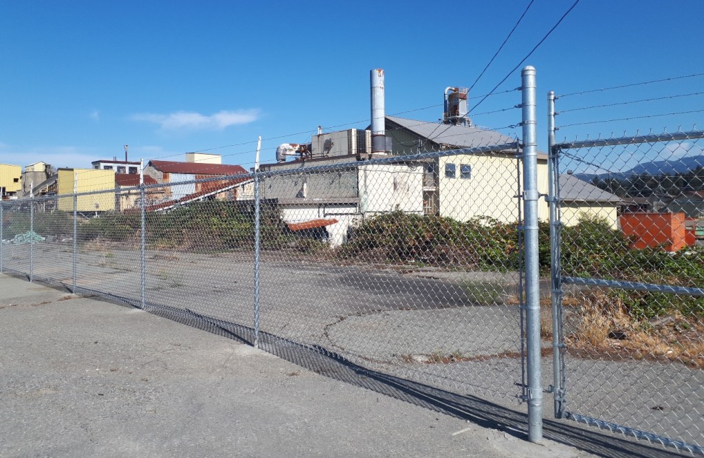
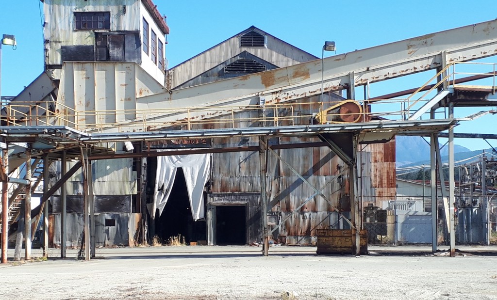
What I know about the Somass Mill isn’t enough. But I have misgivings. I am talking about the five properties totalling 43 acres the City of Port Alberni bought for $5.3 million. The intention was to sell off most of the properties keeping part of it as public waterfront access and Park. The rest would be a mix of retail on the ground floor with living areas above.
Part of the deal is that no primary sawmilling can be done there for 5 years. I know first hand, that the San Group is interested in this property. So I wonder if the popular rumor, that the San Group wants to build a pellet plant qualifies?
Recently, I went on a walkabout there with Chris Alemany and others. He is advocating restoration of the Dry Creek estuary. That is a third option. Several mayoral candidates, a CHEK TV crew, two former senior employees from the mill, and citizens were there. The third option is to recreate the Dry Creek estuary that this site is built on.
What I learned is that the city hired a contractor to conduct Phase 2 technical contamination assessments on the site (See the link for a better idea of what that is.). As part of a due diligence investigation, the City conducted this assessment before the decision to purchase the mill was made.
Jim Rutherford was the Environmental Co-Ordinator of the Somass Mill site for many years before retiring. He learned about the purchase at the same time as the rest of us back in August of last year. Because he felt that he was likely the only staff person from the old mill able to discuss this issue with city staff, he asked for a meeting with Tim Pley and others. At that meeting, he was shown where the assessment samples were taken and showed them the location of key contaminated areas that were not discovered by the consultants. However the purchase had been completed at that time.
Three choices have been described so far: the San Group’s pellet mill, the mixed use of storefront with apartments and/or condos above and a walkway on the waterfront, or complete restoration of the Dry Creek estuary. All of them hinge on what lies beneath and what it will take to remediate the site.
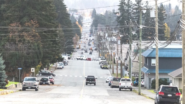
For those who are new to town, the north end of 10th Avenue dead ends at the top of the ravine, or canyon of Roger Creek. One of the reasons there is a traffic bottleneck on Gertrude is because a bridge across the Roger Creek Canyon has never been built. It would take a lot of congestion away from Gertrude Street. And access to the Pacific Rim Shopping Centre, Walmart, and Canadian Tire from South Port would be much faster. It seems like a no brainer.
And a fellow called to say just that, this afternoon. “Why hasn’t it been built?”, he asked.
Well it’s easy to say, there’s no money or political will. But that isn’t a very satisfactory answer. There’s more to it.
First, it would be a very big bridge. From the top of the canyon on one side, to the top of the canyon on the other side is around 250m. It is a longer crossing than the Highway 4 bridge across the Sproat River. So that’s a lot of money to invest. There is no way the City of Port Alberni could pay for it without help from more senior levels of government. That may be more likely now as we have an MLA, Josie Osborne, who is a Minister in the BC Government.
But there are other things to consider, Roger Creek itself. It is a salmon-bearing stream. In former times Coho runs were abundant in it. They are still there but much reduced in number despite numerous efforts to enhance the run. Construction of a very large bridge over a creek with a fragile salmon run could easily make the run even more fragile. It any landslide happened during construction it would end up in the creek immediately. It would also be very difficult to prevent silt and erosion from entering the creek during construction.
And now there’s the fact that The Scott Kenny Trail lies beneath any proposed orientation of the bridge. Construction would creak significant overhead hazards, forcing that part of the trail to close for however long the construction took.
Finally there is the issue of all those people in the neighbourhood at the north end of Tenth would be very unhappy to see their homes, homes that they may have bought because of the wooded ravine out their back door, become a major thoroughfare. I happen to know people who live at each end of the proposed crossing. Nobody likes to be told that it is for the greater good. So we sit…
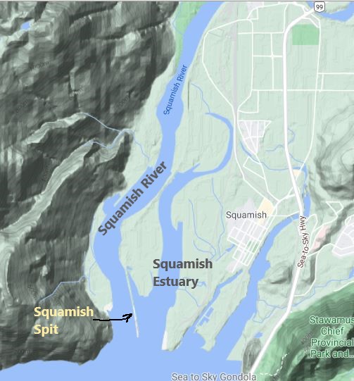
A couple of weeks ago I was watching Global News at Six. A story about the future of the Squamish Spit came on. As I watched, I realised that they had exactly the same issue that we have here in our estuary with respect to Chinook salmon smolts.
In their case, a long narrow berm of fill was built out onto the mudflat of the Squamish River many years ago. It was to serve as part of a coal port that never materialized. The trouble with it is that this “Squamish Spit” separates the river that salmon smolts descend, from the estuary the estuary where they adapt to salt water. For salmon, especially Chinook Salmon, estuaries are critical habitats. Chinook Salmon more dependent on the estuaries than any other salmon species .
Conservationists have long recognised the situation and have called for the berm to be removed. But they are opposed by the Squamish Windsports society who regard their access to the winds of Howe Sound as “Canada’s Premier Kite-boarding Location. It looks like the windsports society is not going to win this one and that the spit will be breached to allow the smolts access to the rest of the estuary.
Chinook smolts must swim out around the end of this spit to enter the estuary,
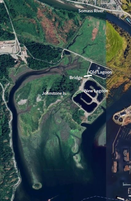
It you substitute a couple of lagoons for the spit, you have the same situation right here in Port Alberni. All the Chinook Salmon smolts have to travel out into the inlet, around our wastewater lagoons and Johnstone Island.
The Alberni Valley Enhancement Association was able to secure funds to conduct a study of juvenile Chinook use of the estuary and confirmed a similar situation exists here at the mouth of the Somass River.
From the report: “Much of the estuary’s eastern shoreline (river-side) has been hardened through industrial, commercial and residential development, and much of the western estuary (i.e., Phil’s Bench area) has been cut-off from direct river connectivity by historic diking and channel-filling practices. Salmon fry and smolts attempting to rear in central and western reaches of the estuary must now migrate around the south end of Johnstone Island (which is no longer an island), and move passively or actively back on-shore in order to find suitable habitats. Given their relatively small size and limited swimming ability, it is problematic whether a majority of naturally-spawned Chinook fry can successfully complete this journey each spring.
So the AVEA recognised this situation and secured funds to replace a part of the access road between the ponds with a small bridge. However, it was recognised that the wastewater effluent from the old pond, that currently empties into the river would then also flow into the lagoon and ruin the water quality. So a dam was built as a temporary solution until the new wastewater plant was completed. The new plant discharges underwater 800m out into the harbour.
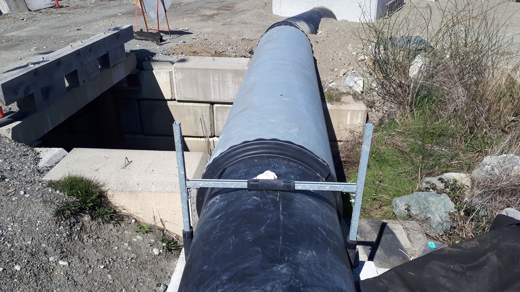
I mentioned that the bridge is a small one. Indeed it is. It is only 4 or 5 m across. The other two bridges over flood channels to the are almost twice as big.
The small bridge between the two lagoons.
Unfortunately the design of the new lagoon didn’t include a longer bridge, or another bridge. There is room to build one, but the opportunity to do so has likely been foreclosed. There is some hope that some of the money set aside for the decommissioning the old lagoon could be used to ensure that water flows freely under the bridge.
It is too bad that, unlike Squamish, this community doesn’t yet appreciate the importance of restoring the only part of the Somass Estuary that is relatively intact. It is only a third of its original size. No wonder the Chinook stocks are struggling.
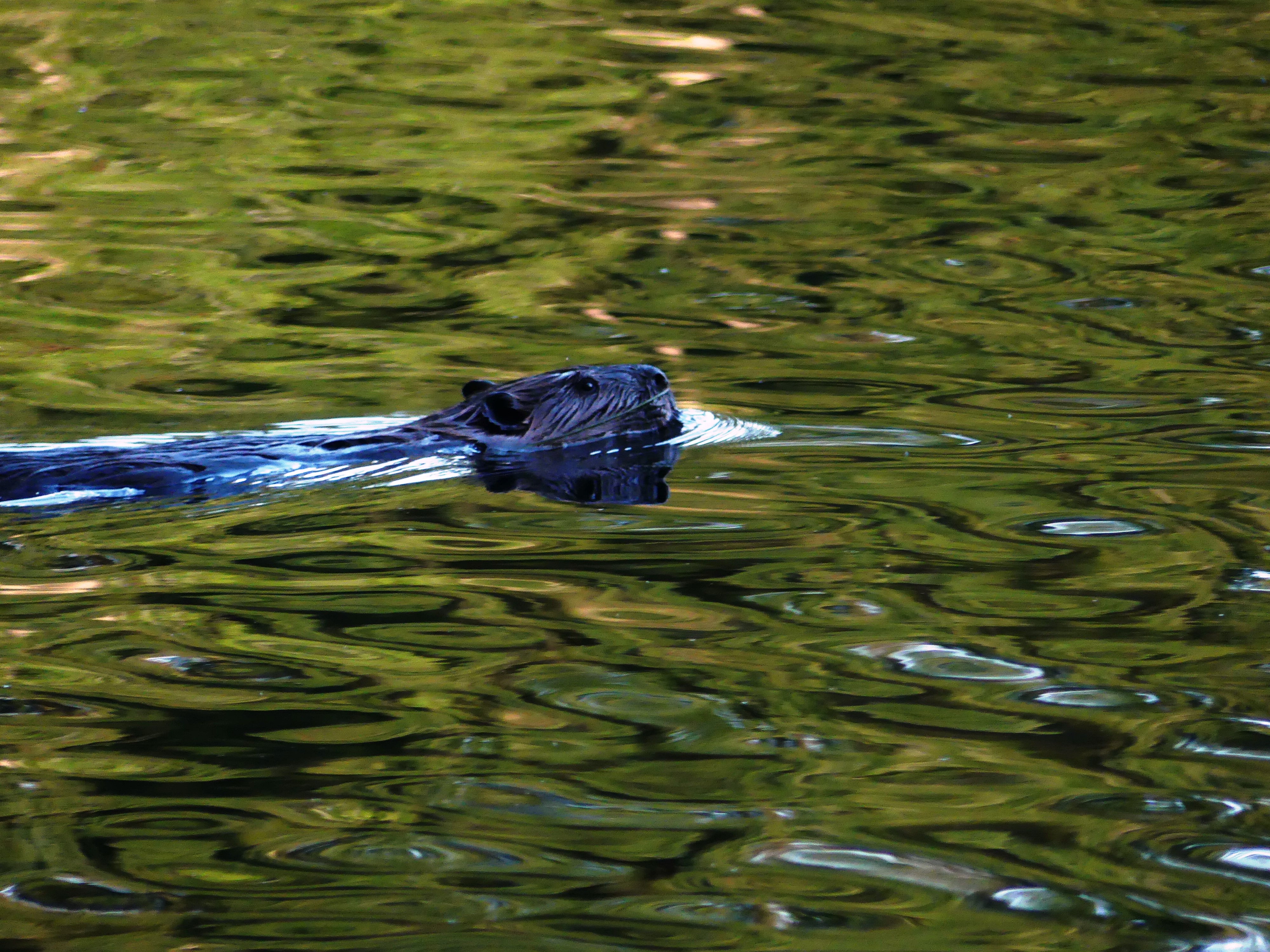
There are two unique ponds way up Burde Street by the Log Train Trail. I think most local people have heard of them. They are unique for several reasons. Being just off the Log Train Trail, they are very accessible and because of that they get an enormous amount of visitors, particularly since the pandemic started. These ponds are an ideal location for students, and the public to watch wildlife and learn the basics of the natural world. They have beavers in them, a variety of colourful ducks year-round, and Western Painted Turtles. These turtles are listed as endangered by COSEWIC (Committee on the Status of Endangered Wildlife in Canada) because of major loss of wetlands and a rapid increase in roads, development, and people. The lower one has an additional unique feature in that a ring of Yellow Flag, or Iris grows around the edge of it. The Yellow Flag is highly invasive. But it provides a spectacular display of colour in May. Beside this pond is a spot with a wonderful wrought iron bench is chained to a root and provides a relaxing view of the pond. My thanks to “Frank”, who must have placed it there. He tells us to enjoy the pond in a note written on the back of it.
The property around them was once considered semi-rural. But since the city extended their boundary to end of the road, a lot of houses have been built on the other side of the street, with more under construction.
I spoke to a real estate agent about the property. He seemed to know something about it. But he said he was bound by confidentiality in being able speak to plans for property. However, he was able to say that he was impressed that the owners are looking to develop the area in a greener manner than has ever been tried here. He further said that they would be announcing proposed plans for the property, along with another property west of the Log Train Trail soon.
The beavers in the ponds have been there for years and years. Being the headwaters of a creek known locally as Wolf Creek, the beavers likely followed the creek up from Roger Creek. Two beaver dams are located where the upper pond empties into a creek that feeds the lower pond, that in turn, empties under the Log Train Trail, where more dams are located. When they moved in and built them, the beavers raised the level of the ponds. As a result, large trees died around the edges providing homes for a variety of, first, woodpeckers, and then swallows, starlings, Hooded Mergansers and Wood Ducks. It is the beaver that maintain the water level of the ponds with their activities. If they should be so disturbed by development that they leave, or die for some reason, the dams will eventually break and the water levels will drop significantly.
The north edge of the property is the City Limit. Beyond that is the Hupacasath’s Woodlot Licence. It provides older forest and a wilder habitat connection to both ponds, particularly the upper pond, because the pond extends about 50 meters into the Woodlot.
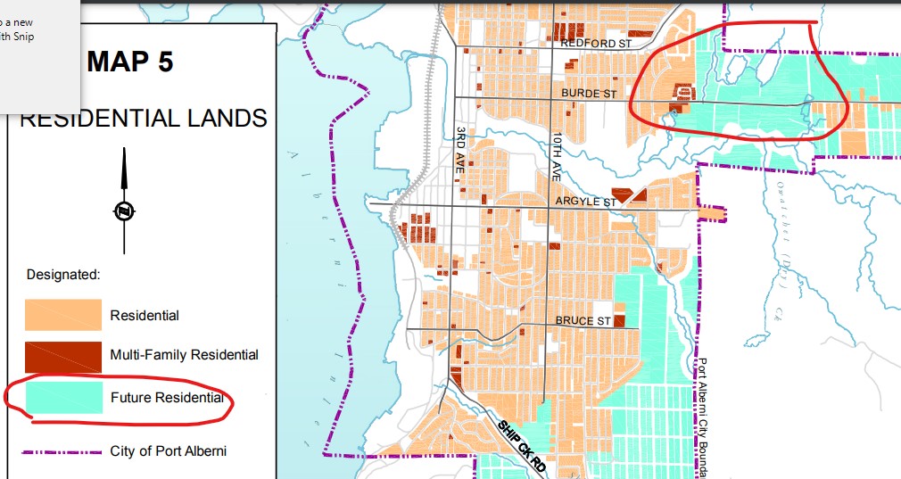
From a regulatory perspective, the entire property except for the ponds and a small area around the lower one is proposed for Future Residential in the City’s Community Plan. And the Zoning map shows low density multiple family residential around the upper pond with lower density single family residential being further away from them. To reduce the activity around the ponds, it should be the reverse with the multiple family residential being further away. In fact development between the two ponds should not occur. And to that end I suggest that part of this property could be subdivided and offered to an organization such as The Land Conservancy of BC, or Ducks Unlimited for safe keeping. A community campaign to purchase the property could support the offer.
The thick dashed line is the city limits. The others, lot lines.
The ponds are circled in red
The zoning map that should be “local commercial” I couldn’t squeeze it in.
Being modestly more remote, the upper pond is the more sensitive of the two. It is where the turtles live and where the most ducks spend their time. This zoning map shows how fragile the future wildlife in the ponds is.
I know I am not the only one who is concerned about the effect of future development in the area. I have heard rumblings from various people. And the real estate agent I spoke to added verification to it when he acknowledged that he has heard them too. Here we are playing with the headwaters of a highly endangered fish creek that drains into another highly endangered fish creek, Roger Creek. The area is also very popular with the public as it is part of a highly developed network of trails and is used for walking dogs, woodland running, and childhood adventures. City council needs to reconsider its planning for this area before considering any plans put forward by a developer.
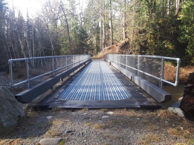
The bridge to nowhere. This bridge was built about 3 years ago in anticipation of the trail extending all the way down to Roger Creek Park
A couple of weeks ago, several staff from the City met with Lyman Jardin and me at the footbridge over Roger Creek to discuss possible routes to create a path from the “bridge to nowhere” off the end of the Scott Kenny Trail, to Roger Creek Park. This route has been promoted as part of a pedestrian system through the city.
City CAO, Tim Pley introduced the new City Engineer, Rob Dickinson, and Rob Gaudreault before heading off. We climbed down from the railway tracks to Roger Creek observing the obvious signs of potential slides and slope failure, and then hiked through the brush along the south side of the creek. We got as far as the proposed bridge crossing that would bring the trail to the south side. It has to cross the creek, as there are big gravel cliffs and old slides along the north side just downstream. There is no possibility through the upper part of the north side.
Of course we talked the entire time. Eventually it was determined that there are three possible routes:
The South Side Riparian choice seems to be the one preferred by the city staff. They were pushing it during the conversation. Dickinson remarked that you can build anything if you have enough money. You can’t argue with that. But there are some issues with this choice. It is the one that will have the biggest impact on the Salmon left in Roger Creek.
It still is a fish creek, despite many habitat damages along it besides logging. But it is a shadow of what it once was in former times. A land fill was located on its bank. A storm water drainage pipe empties into a settling pond behind the fair grounds. There are now 5 bridges across its lower reaches. The Scott Kenny Trail has opened up the forest along its banks exposing the creek to dangerously elevated temperatures in the summer. Side channels for rearing and overwintering salmon, and settling pond for the storm water runoff were constructed at the same time as the trail. This opened up a large area to the heat of the sun. But all of them are stagnant, unsuitable habitat for salmon. A reforestation reforestation attempt was done clumsily, and a crucial part of it around the rearing channel failed. A number of vehicles were pushed over the rime and are there still. And over the last few years someone has been dumping fill into the creek near the mouth of the creek.
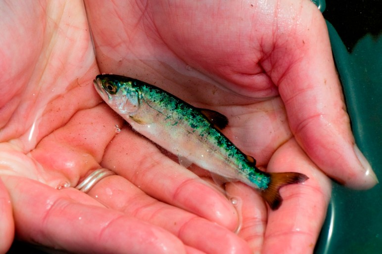
Yet still, it is considered a fish creek. There are 9 kms of suitable habitat before a waterfall barrier prevents further habitat use upstream. Signs are up in Roger Creek Park telling them about salmon and the salmonid habitats of the creek. In 2017 during construction of the Scott Kenny Trail, a settling pond and rearing channels was built, as well as 2 other side channels further down. And I have photos of Coho parr from 2014. And there have been other efforts as well to enhance habitat and restore fish to it.
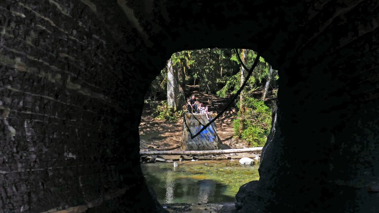
Base of Railway trestle showing how high water laps at the bottom of it.
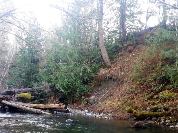
A scar from a landslide just upstream from trestle
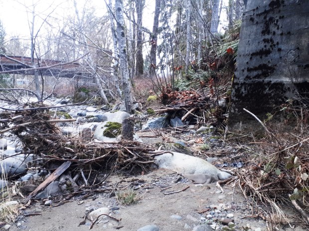
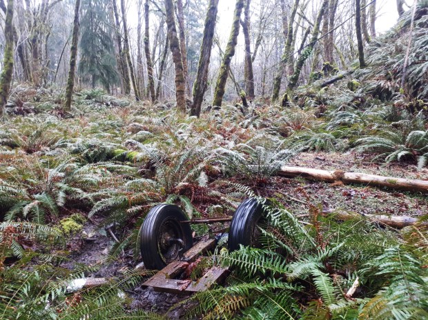
One of the discarded old vehicles littering the ravine.
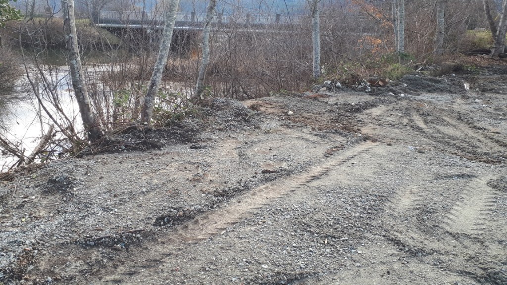
Fill dumped into the mouth of Roger Creek
All that aside, the most contentious part of the proposed path is the 100 meters just upstream from the Roger Creek pedestrian bridge. Here the rail trestle crosses the creek. And the cement support columns stand at the very edge of the creek. Every fall and winter the base these columns are washed by the flooding creek. There is no place to put a path under the bridge unless it is elevated above the highest water mark and supported by one of these columns; or unless the city gets special dispensation from Fisheries and Oceans.
The South Side Riparian route also follows the base of a very steep muddy bank with a recent slide scar on it and plenty of other signs of slope instability. At the bottom of the bank is Roger Creek. There is a very high probability that any construction at the base or along the bank (such as cutting trees and brush), would cause a slide. And again any path constructed would infringe on the creek itself because there is so little room below the bank. Can we take that chance on a salmon run that is in such a precarious state?
The Lower North Side, follows a route similar to the South Side Riparian Route, but after half way the path would cross the creek and go under the column on the north side of the creek. Again it would infringe on the creek as it is as wide as the columns. However the slope stability issues are not present. In their place though is the fact that the path would impinge on the private party of an influential citizen who has made it clearly known that he would not permit this to happen in his own back yard.
The third possibility that I like is to climb the ravine from further upstream and connect either to the north end of Glenwood Drive, or follow the edge of two properties where there is an existing rough and sketchy trail to the railway tracks. This route eliminates slope stability issues. But near the top it is steeper and may require steps near the top.
It also means dealing with two private property owners. However, these owners may be more sympathetic to the cause. One of them is JW Berry Trucking who has already acknowledged that there is a lot of foot traffic along the back of his property by building a path of his own. The other property is owned by Heatherington Battery. And they keep porta-potties inside a tall chain-link fence. The existing “trail” is at the very top of the ravine, at the top of the very unstable slope. Tim Pley made a remark that gave me the impression that Hetherington might be amenable to selling a ten-foot strip along the north end of his property, enabling a safer path to be built away from the top of the ravine. That would get the route to the right-of-way of the railway tracks.
The right-of-way is owned by the Island Corridor Foundation. Pley was doubtful whether the Island Corridor Foundation would be amenable to permitting pedestrian traffic to cross the railway lines. After all their purpose is to restore the rail line. There may be a possibility of constructing steps down from the Hetherington property and under the tracks between the south column and the approach embankment. There is a fairly level spot there and then more steps will easily take you down to the approach to the south end of the footbridge. All of the proposed routes will cross the right-of way of the Island Corridor Foundation whether over the tracks or under them.
Of course it all comes down to money. Pley says that the City is able to write a proposal for a million dollars that will enable them to get the money. However, they still haven’t consulted fisheries for their opinion/conditions, or a geotech about slope stability. Nor has any engineering been done. I understand that some of the grant money will go towards that. And what’s designed will be contingent on what fisheries and the geotech has to say, as well as the Island Corridor Foundation’s permission.
It should also be contingent on a decision that the city must make about the level of access that is desired. Is the path going to be wheel-chair-accessible, or accessible for cyclists? Or will it be accessible to pedestrians able to climb steps. From there plans can be made and estimates of cost after that. I hope that this third alternative, the one along the top of the ravine, is not dismissed and left un-costed. Then we will see whether the costs of each alternative are reasonable or whether this trail will even be built, period. Personally, I think this is ambition to have a trail continue down Roger Creek to the park is a tough nut to crack if the City Council demands gentle grades for this trail.
I was surprised to see a majority of people responding negatively to the Alberni Valley News poll on making the Hole-in-the-Wall a tourist attraction. A convincing majority are against it. But a poll on something like this is mostly answered by people who haven’t given the issue any thought, or looked into the issues. Still, it is daunting. Something needs to be done whether the majority is against it or not.
I Googled Hole-in-the-Wall to see how many sites promoted it. I stopped counting sites mentioning Hole-in-the-Wall at 50. They include, the Chamber of Commerce, a three hiking apps, Trip Advisor, Flickr, several blogs, YouTube, Instagram, Pinterest, and many, many more. There is even a Chinese language site featuring it. Word-of-mouth is also an important factor in the popularity of the site. Closing the attraction without notifying all these sites would result in a lot of unhappy visitors, and damage to Port Alberni’s fragile reputation for tourism.
Crowds start in April and go into October at both entrances. They are regularly plugged up with vehicles, with the overflow going into Coombs Country Candy. Erosion, trampling and garbage are also an issue.
Ask the RCMP how many accidents, near misses, and incidents have happened around Coombs Country Candy, and the Black Powder Range Road. Then there are the people who find no parking and park at the candy store. Then they scamper across the highway, some taking chances with the traffic because of their impatience.
It’s not just the Hole-in-the-Wall that is the attraction, although it is a pretty good name. Across the road we have a lookout, a trail network, downhill mountain bike courses, and a starting point for ATV adventures. Also, Coombs Country Candy is definitely part of the attraction. It is a wonderful spot to relax after any of these activities. The owner, Murray Lawlor, tells me it is very much a part of the success of his business. But he worries about the risks that people who park at Coombs Country Candy take when they cross the highway.
It is high time that the Regional District, Mosaic, Highways, and Lawlor sit down and come up with a plan. Investment is necessary. To Mosaic, I say that there may be a way to lease some property and therefore get some revenue from the land, perhaps from admission charges. Those same admission charges could also pay for the investment in parking, way-finding, and maintenance. Perhaps also, a resort developer could work with the parties to add value to the area.
It is easy to throw out ideas. Perhaps some of them will spark an idea in someone’s head, who is better positioned than I am to make things happen. Leading public opinion is an important quality of leadership. I have to trust that our leaders agree. But I think something has to change, because the alternative is increased degradation of the attraction itself.
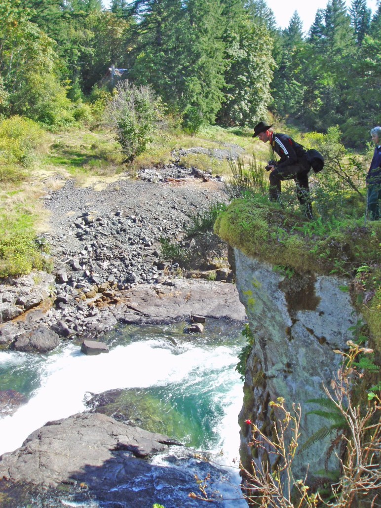
I think Sproat Falls is one of the most over-looked tourist attractions in the Alberni valley. Despite it being less than 100 meters from the Highway 4 Bridge over the Sproat River, the falls are scarcely even visible from it and there are no signs to indicate that it is there. A million people a year are reputed to travel this highway a year. Many of them are from out of province, out of country and out of continent. It’s a big trip for them. They have all heard about the salmon migration, and whether they are fishermen or not, they would love an opportunity to see the migration in action.
Sproat Falls is a place where at least 100,000 sockeye salmon pass every year with the majority passing between mid-June and mid-July. At that time the abundance of fish is impressive. It could be very easy for the travelling public to stop for a few minutes in their headlong dash to the Pacific Rim. The fish ladder there, the cliff and the old forest perched at the top of it, combine to make it quite scenic. And it’s hardly even a detour.
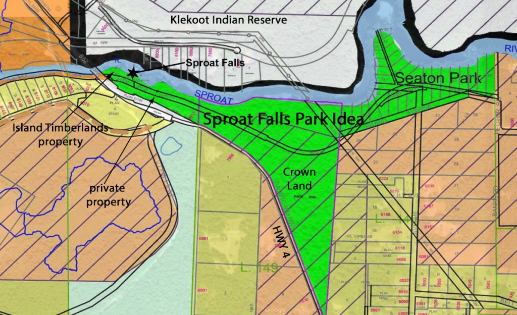
The area should be a park of some sort. In fact, it almost is. Part of the area is designated Park Use on the Alberni-Clayoquot Regional District’s Official Community Plan (OCP) for the area and it is Crown Land. But there are some hurdles, and a bit of leg work to actually make it so.
There are 5 properties involved. See the map below taken from the Regional District’s Official Community Plan map. it is slightly modified Of the five, the two biggest properties are public lands, Seaton Park, and the pie-shaped property adjacent the Park. Seton Park belongs to the City of Port Alberni. I’m not sure why. The other property is an isolated chunk of Crown Land. It shades Highway 4 with some nice old forest. Through both properties goes an old grade Google Maps calls Brand Avenue. It starts at the end of Hector Road and ends just above the Highway 4 Bridge and may have been an old rail grade.
There is an error in this map. The western part of the green section is actually privately owned. There are three small properties, one on each side of the old grade and a third at the westernmost end. The latter is owned by Mosaic Forest Management. The property next to the highway is privately owned. The Property next to the river is undeveloped and likely could never be developed because the setbacks for buildings required by the Regional District virtually eliminate any possibility for building on it. I don’t know who the owner is. Finally just before the bridge there is a smaller parcel of Island Timberlands property that also has little value for the same reason.
Brand Road is an extension of Hector Road. It is used by fishermen’s pickups who want to access Seaton Park, and by cyclists who want to avoid Highway 4 on trips back and forth to Port Alberni from the lake. But, for the most part it, seldom used. However, it could become part of a recreational corridor along the Sproat River all the way to Sproat Lake Provincial Park. The start of Hector Road runs through the Tseshaht Indian Reserve, past Arrowvale Campground, past Somass Park (another odd City Park outside the City Boundaries) before it turns left runs through some rural properties and becomes gravel, where it becomes Brand Road. It goes past an obscure trailhead to a cliff overlooking Sproat Falls. It then proceeds under the Highway 4 bridge upstream to the Ash Main bridge over the Sproat River. This bridge is condemned to vehicle traffic, but is very popular for walkers as it goes all the way past the Petroglyphs to Sproat Lake Provincial Park. From this part of the road several trails to, and along the river itself.
Clearly, there is some legwork to be done before it can be considered a Park. The owner of the private properties need to be contacted to see if any could be sold to the Regional District. Another option could be through a covenant or some other creative arrangement. Similarly, a negotiation has to take place with Mosaic. The Regional District also needs to talk to both the city of Port Alberni and the Province. A plan needs to be drawn up for parking washroom facilities and perhaps a fence along the top of the cliff. This adds up to a fair bit of staff time. And the cost to acquire the properties and to install the facilities may not be exactly modest.
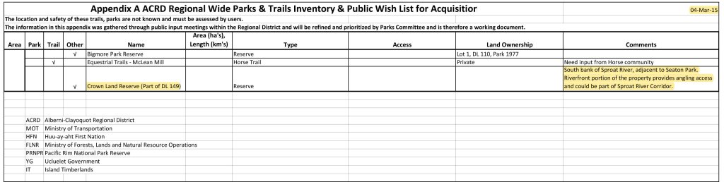
It comes down to political will. Is the current or future Regional District board willing to make the effort. They have taken some steps along the way. It is in the Sproat Lake OCP. They have established a Parks Service Review Committee. And they are exploring ways of acquiring and funding a Regional Park system. In 2015 they produced a Parks & Trails Strategic Plan where a framework for the acquisition and establishment for parks and trails was laid out. Buried at the end of Appendix A, the Public Wish List, these properties are mentioned. Clearly from a local’s perspective, this area is a very low priority. From the travelling public’s perspective it is completely unknown. That is why I say it is the most overlooked tourist attraction in the Alberni Valley.