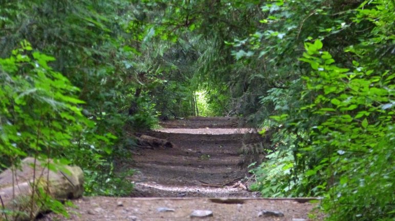
A recent public engagement effort on the Log Train Trail left me thinking about decisions the ACRD has made regarding Off Road Vehicles (ORVs) on the Log Train Trail.
The ACRD Board has adopted a Management Plan that says that traffic by ORVs is around 50%, more than by all other uses combined. I’m not at all surprized. These vehicles and their reputation have figuratively driven many hikers off this trail. And now you’ll see even fewer of them. Hikers, cyclists, and horseback riders are incompatible with ORVs. They were saying that 40 years ago in my forest recreation class at university! Yet hear we are!
Some of the ACRD’s portion of the trail must remain ORV-free. That wasn’t an option in the consultant’s management plan. Did the Board have the imagination to consider this?
To me, the ACRD has dragged its feet right from the start, through the whole process of creating the Log Train Trail and maintaining it. It hasn’t abided with the agreement with the Ministry of Transportation that restricted its use to Active Transportation. Enforcement of this requirement has been negligible. Have any of the complaints been resolved by penalty?… Any? Or have they all quietly disappeared? So how can the board reps and staff speak of it as a done deal? “It just has to get by the Ministry of Transport.” We’ll see about that!
I mentioned that the reason there is so much use of the Log Train Trail by ORVs is because pedestrians are reluctant to use it. With this decision, it is completely unmanaged until a committee is struck, meets, and makes a strategy for transiting to the plan. So, do what you like folks! There are no restrictions! And they won’t enforce any that do come into play.
It really irked me to be told at the meeting that the City should have no say on the committee to implement the recommendations when they have two seats on the board.
You know, the irony of all this is that the Management Plan commissioned by the ACRD was funded by the Canada Active Transportation Fund. What is “Active Transportation”? Active transportation is using your own power to get from one place to another. This fund is set up to promote Green Transportation! Just the opposite is the result of the plan!
I’m actually going to make an election promise! I promise that if I am elected to city council, I will fight tooth and nail, scratching and clawing to get better signs at the trailheads around town by the end of my term. I want the trail maps to have North at the top, to have the roads visible and not just the road names, maps that aren’t so faded you can’t read them anyway. They’ve been like that for at least 4 years. It’s just embarrassing.
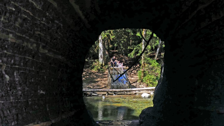
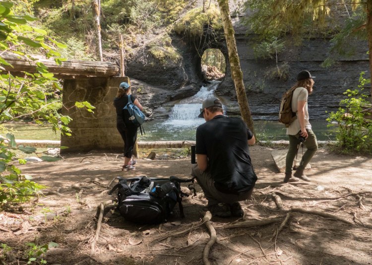
There is a debate in town about whether this place should be a tourist attraction. Some say it already is. Others say “keep it as is”. And other issues swirl around it. The actual location of the hole is on land owned by the City of Port Alberni, but getting to it is on land controlled by Mosaic Forest Management. They are not known for welcoming people on their property without due notice. And there is more stuff too. Here are a few shots of it to illustrate what else is there.
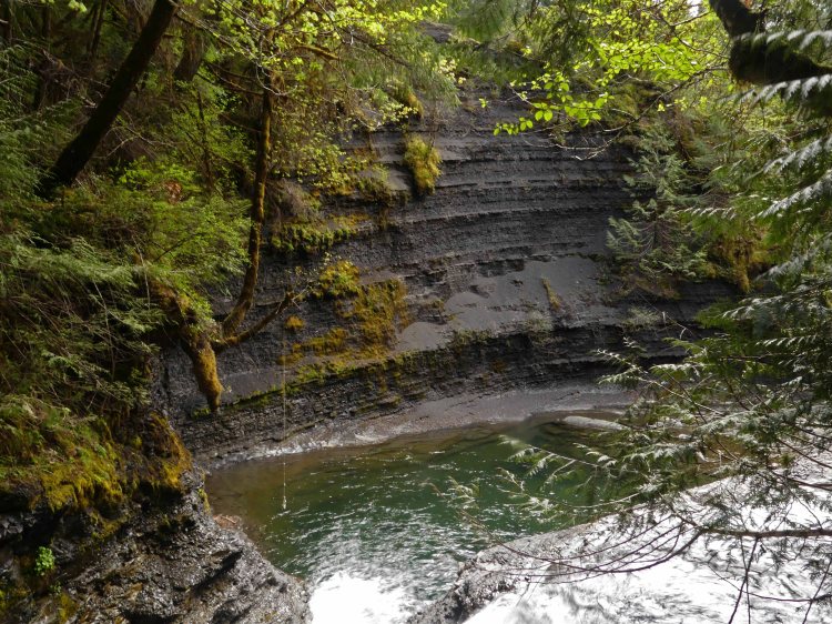
Roger Creek makes a U-turn at the Hole-in-the-Wall. Here it is cutting through cliffs of shale, a very soft rock. So the early engineers who built the first waterworks for Alberni took a short cut through the rock wall
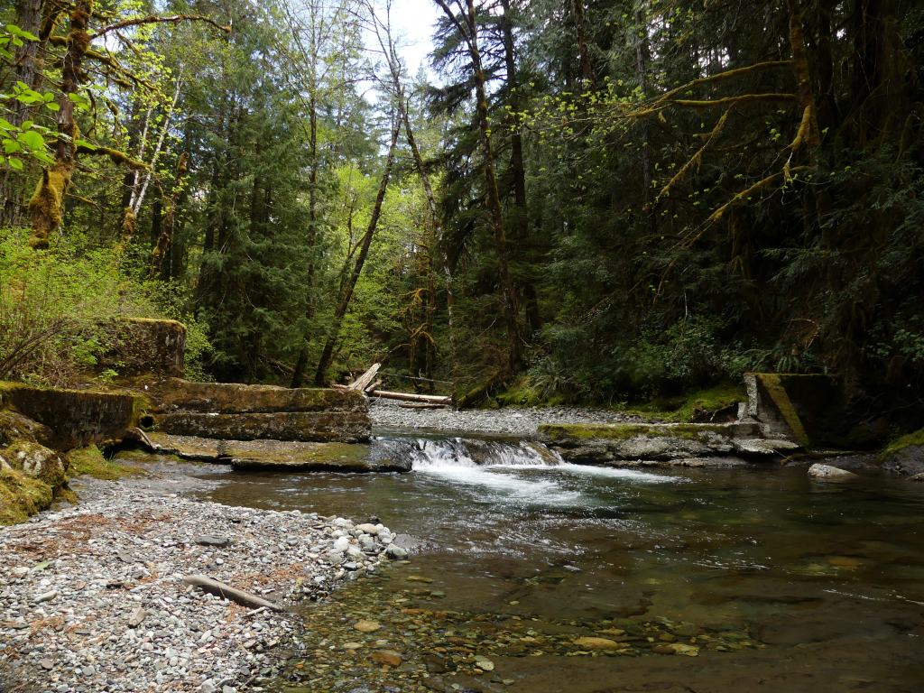
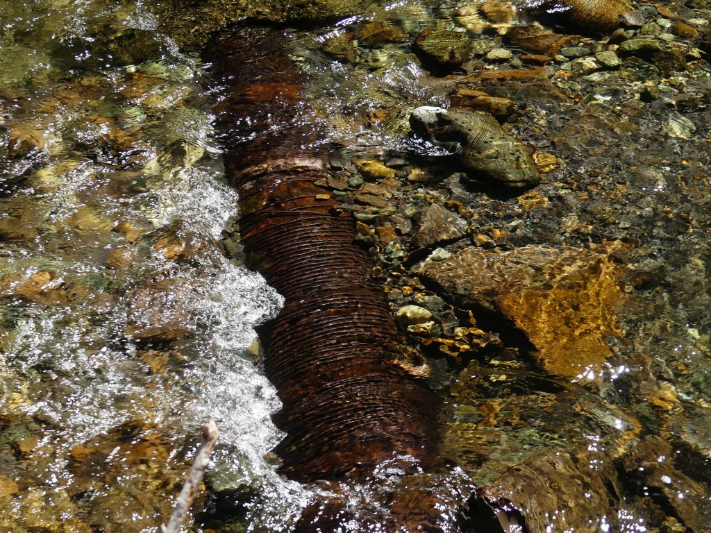
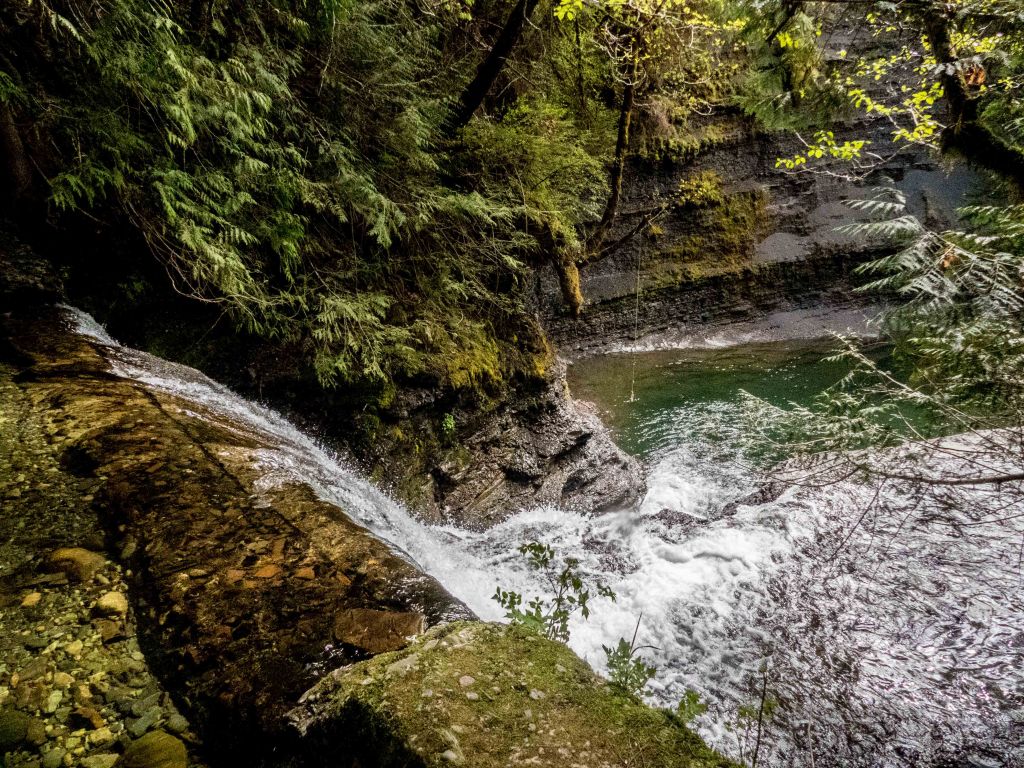
And the water falls into a little swimming hole where only the most adventurous dares to use the rope.Upstream from the Hole, where Stokes Creek joins Roger Creek is another dam from the same ptoject. The end of an old pipe is visible on the right.The remains of the first water supply to serve Alberni before it merged with Port Alberni originally. These hoops originally bound wooden staves. However, a century later, just the the hoops are left.
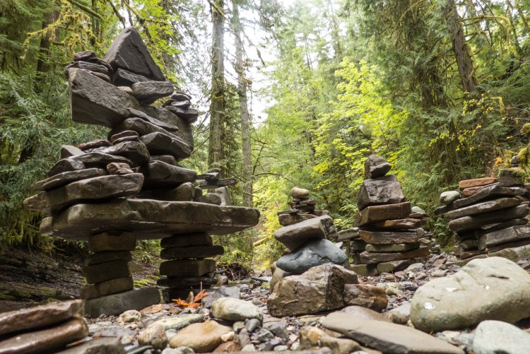
A rough trail leads downstream from the Hole-in-the-Wall to this dam at the top of a waterfall…Seekers Media Video crew in the field. Hired by the city and its partners to promoting things to do in the valley, whether they are on private land or not. there have been other film crews here as well.These Inukshuks were all built by visitors playing with the flat rocks that litter the creek banks. Roger Creek has some of the best skipping stones I’ve ever seen.
I think Sproat Falls is one of the most over-looked tourist attractions in the Alberni valley. Despite it being less than 100 meters from the Highway 4 Bridge over the Sproat River, the falls are scarcely even visible from it and there are no signs to indicate that it is there. A million people a year are reputed to travel this highway a year. Many of them are from out of province, out of country and out of continent. It’s a big trip for them. They have all heard about the salmon migration, and whether they are fishermen or not, they would love an opportunity to see the migration in action.
Sproat Falls is a place where at least 100,000 sockeye salmon pass every year with the majority passing between mid-June and mid-July. At that time the abundance of fish is impressive. It could be very easy for the travelling public to stop for a few minutes in their headlong dash to the Pacific Rim. The fish ladder there, the cliff and the old forest perched at the top of it, combine to make it quite scenic. And it’s hardly even a detour.
The area should be a park of some sort. In fact, it almost is. Part of the area is designated Park Use on the Alberni-Clayoquot Regional District’s Official Community Plan (OCP) for the area and it is Crown Land. But there are some hurdles, and a bit of leg work to actually make it so.
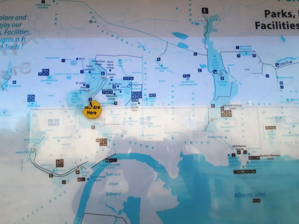
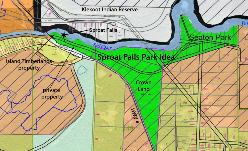
There are 5 properties involved. See the map below taken from the Regional District’s Official Community Plan map. it is slightly modified Of the five, the two biggest properties are public lands, Seaton Park, and the pie-shaped property adjacent the Park. Seton Park belongs to the City of Port Alberni. I’m not sure why. The other property is an isolated chunk of Crown Land. It shades Highway 4 with some nice old forest. Through both properties goes an old grade Google Maps calls Brand Avenue. It starts at the end of Hector Road and ends just above the Highway 4 Bridge and may have been an old rail grade.
There is an error in this map. The western part of the green section is actually privately owned. There are three small properties, one on each side of the old grade and a third at the westernmost end. The latter is owned by Mosaic Forest Management. The property next to the highway is privately owned. The Property next to the river is undeveloped and likely could never be developed because the setbacks for buildings required by the Regional District virtually eliminate any possibility for building on it. I don’t know who the owner is. Finally just before the bridge there is a smaller parcel of Island Timberlands property that also has little value for the same reason.
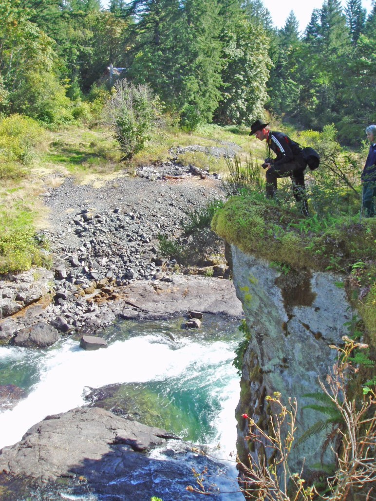
Brand Road is an extension of Hector Road. It is used by fishermen’s pickups who want to access Seaton Park, and by cyclists who want to avoid Highway 4 on trips back and forth to Port Alberni from the lake. But, for the most part it, seldom used. However, it could become part of a recreational corridor along the Sproat River all the way to Sproat Lake Provincial Park. The start of Hector Road runs through the Tseshaht Indian Reserve, past Arrowvale Campground, past Somass Park (another odd City Park outside the City Boundaries) before it turns left runs through some rural properties and becomes gravel, where it becomes Brand Road. It goes past an obscure trailhead to a cliff overlooking Sproat Falls. It then proceeds under the Highway 4 bridge upstream to the Ash Main bridge over the Sproat River. This bridge is condemned to vehicle traffic, but is very popular for walkers as it goes all the way past the Petroglyphs to Sproat Lake Provincial Park. From this part of the road several trails to, and along the river itself.
Clearly, there is some legwork to be done before it can be considered a Park. The owner of the private properties need to be contacted to see if any could be sold to the Regional District. Another option could be through a covenant or some other creative arrangement. Similarly, a negotiation has to take place with Mosaic. The Regional District also needs to talk to both the city of Port Alberni and the Province. A plan needs to be drawn up for parking washroom facilities and perhaps a fence along the top of the cliff. This adds up to a fair bit of staff time. And the cost to acquire the properties and to install the facilities may not be exactly modest.
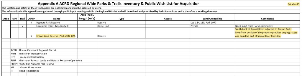
It comes down to political will. Is the current or future Regional District board willing to make the effort. They have taken some steps along the way. It is in the Sproat Lake OCP. They have established a Parks Service Review Committee. And they are exploring ways of acquiring and funding a Regional Park system. In 2015 they produced a Parks & Trails Strategic Plan where a framework for the acquisition and establishment for parks and trails was laid out. Buried at the end of Appendix A, the Public Wish List, these properties are mentioned. Clearly from a local’s perspective, this area is a very low priority. From the travelling public’s perspective it is completely unknown. That is why I say it is the most overlooked tourist attraction in the Alberni Valley.